The Interspect Ltd. primarily produces aerial ortho image maps by RGB, MS or HS remote sensing and develops airborne instruments.
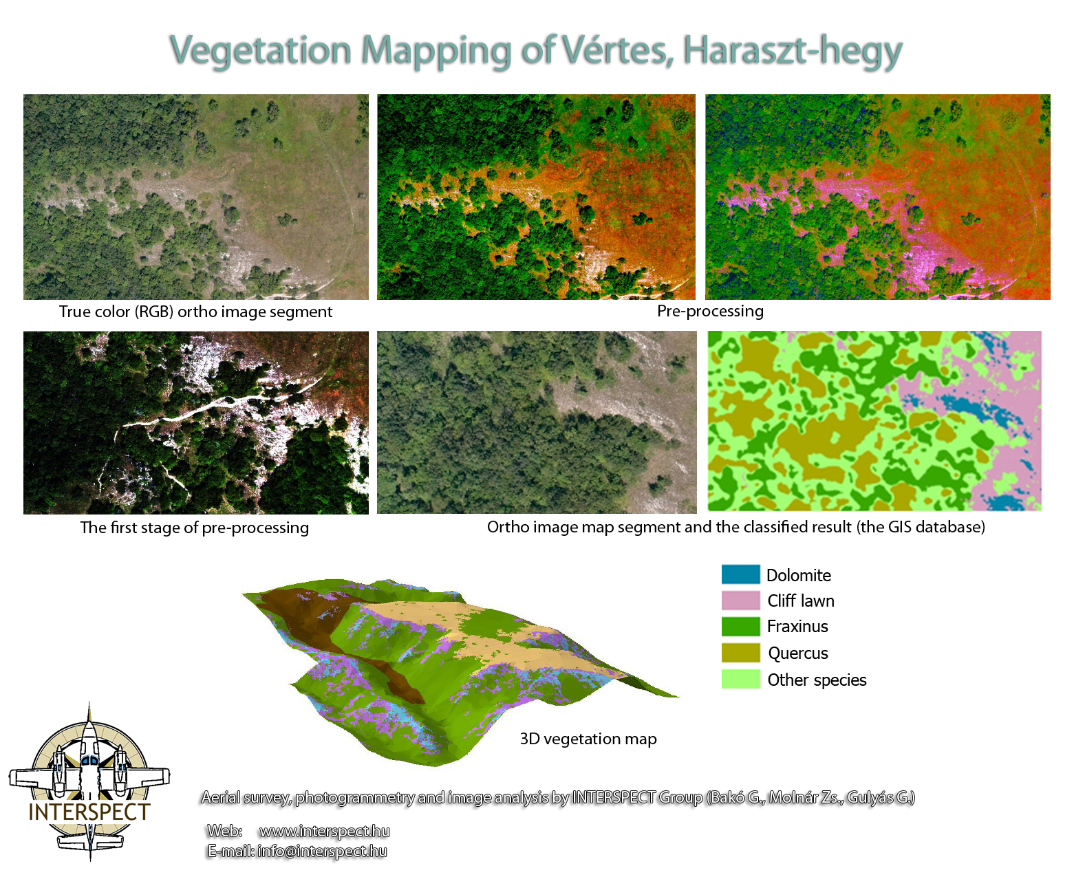
Aerial Surveys for Vegetation Mapping and Forest Management
 "
" "
" "
"3D survey of canopy

The Interspect Ltd. primarily produces aerial ortho image maps by RGB, MS or HS remote sensing and develops airborne instruments.
" " "3D survey of canopy